North Lake Trail – Project Overview
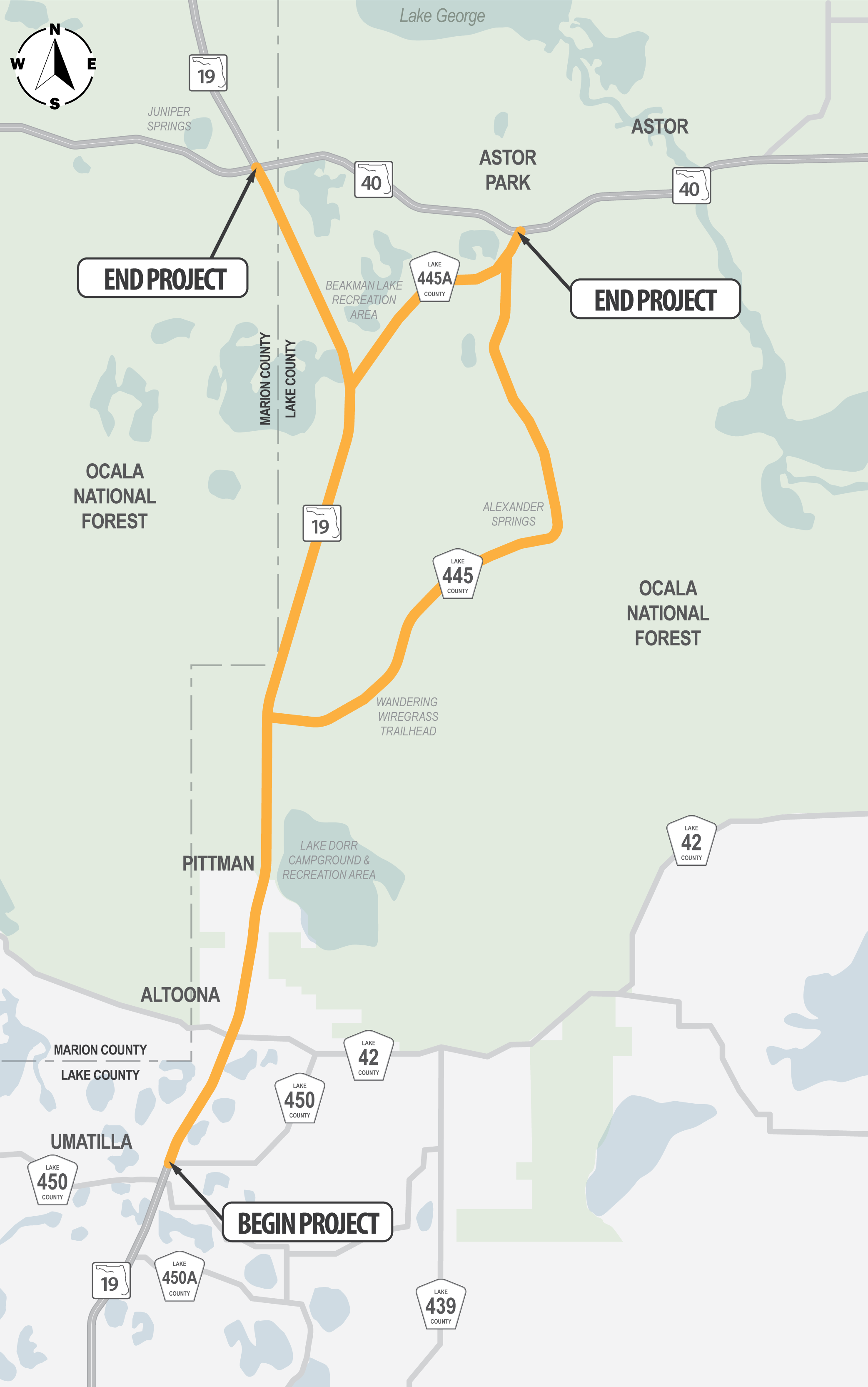
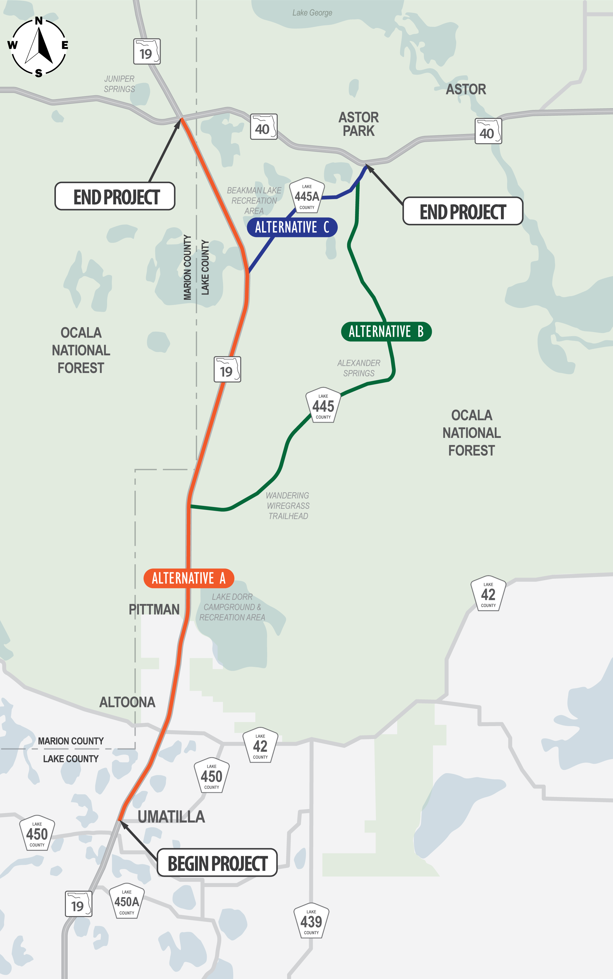
The Project Development and Environment (PD&E) Study for North Lake Trail Phase 3 will identify the best location for the trail that will connect E. Altoona Road to State Road 40, as shown in the project map below. This segment of the North Lake Trail is approximately 16 miles in length. Part of the study area is located within the Ocala National Forest (Forest). The Forest, managed by the U.S. Forest Service, was established in 1908 with 128,000 acres and has grown to its current size of 386,000 acres. Alexander Springs, located within the Forest, is one of 27 first-magnitude springs within Florida with access located off of County Road 445.
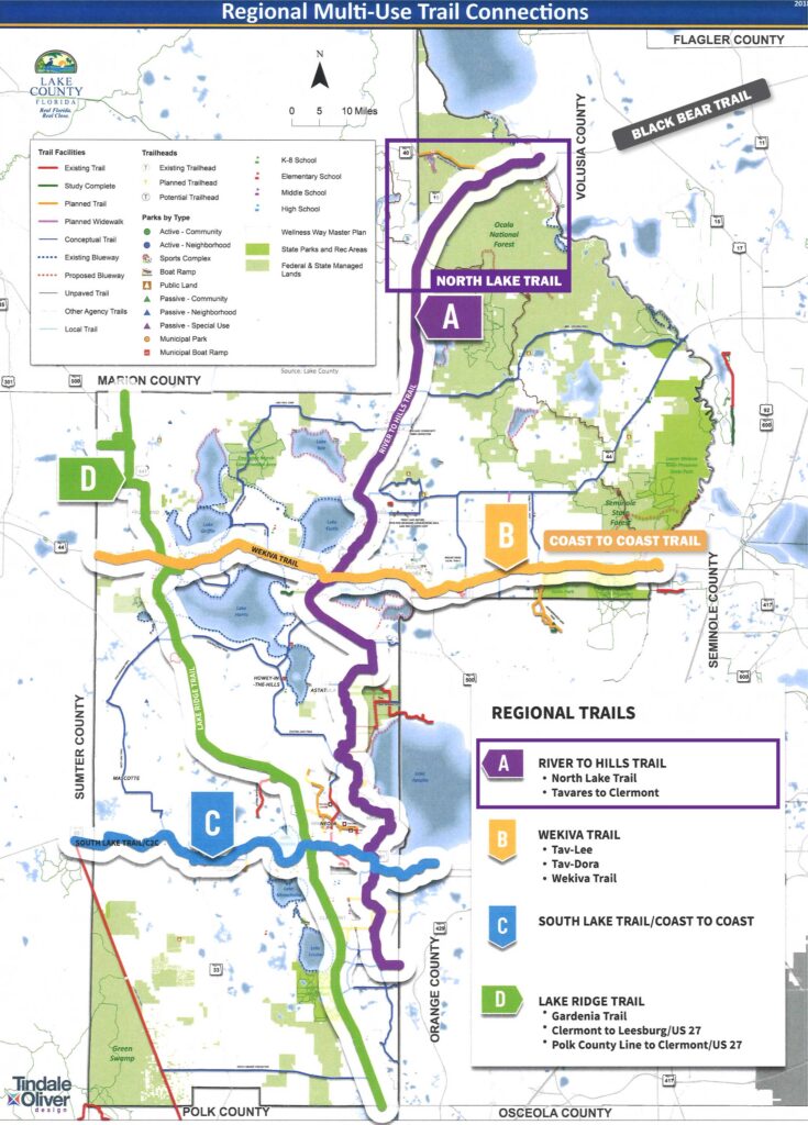
The North Lake Trail is part of the regional River to Hills Trail, which connects Lake County to the Forest. It intersects with the Coast to Coast and Black Bear Trails, as shown on the Lake County Regional Trails Map here.
Lake County identified the need for the North Lake Trail as part of its regional trails network in the 2008 Trails Master Plan and in the 2018 update. This trail also is included in the comprehensive plans for Lake County (2040, updated March 2018) and the City of Umatilla (2035). In 2021, the Lake-Sumter Metropolitan Planning Organization (MPO) ranked this project as #2 on its Trails Priorities List and as #3 on the PD&E Studies Priority List.
Trail Alternatives
In April 2019, the Florida Department of Transportation (FDOT) completed the Corridor Planning Study for North Lake Trail – Phase 3, which focused on the State Road 19 corridor from County Road 450/Bulldog Lane (in Umatilla) to State Road 40. The Planning Study recommended that three alternatives be evaluated in more detail during the PD&E Study:
- Alternative A: following State Road 19 from E. Altoona Road to State Road 40
- Alternative B: following State Road 19 to County Road 445, then County Road 445 to State Road 40
- Alternative C: following State Road 19 to County Road 445A, then County Road 445A to State Road 40
In 2022, Lake County initiated the design phase for the North Lake Trail segment located immediately south of the PD&E Study segment. The design segment is from E. Collins Street (in Umatilla) to E. Altoona Road (in Altoona). The teams for both projects are working closely together to ensure that the PD&E Study’s southern terminus matches the design’s northern terminus. Information about this design project can be found on the Design Segment tab on this website.
